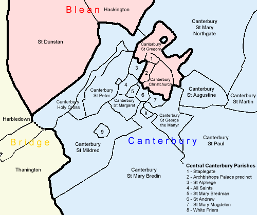
The map shows the layout of the Victorian parishes and Registration Districts in the centre of Canterbury. Registration Districts are colour-coded, note that Blean (pink) includes a detached portion in the centre of the city.
< Back
8 April 2005